

UN approves a new world map without distortions of area
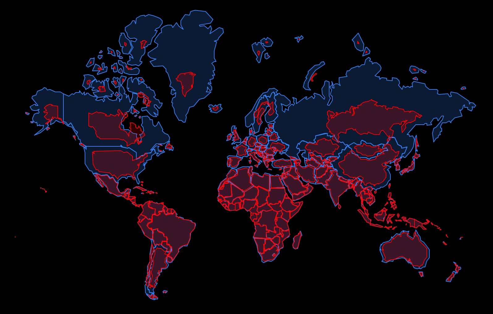
The UN General Assembly has backed a resolution calling for a move away from the traditional Mercator projection in favor of maps that more accurately represent the areas of continents and countries. A total of 164 countries voted in favor of the document, six abstained, and the United States was the only country to vote against it. The resolution is not legally binding.
The resolution primarily concerns the Equal Earth projection, developed in 2018. Unlike the Mercator projection, it preserves the correct relative proportions of areas. On the traditional map, territories closer to the poles appear visually enlarged, making Russia, Canada, the United States and Europe look significantly larger than they are compared with territories near the equator.
The most noticeable change will be for Russia and Canada. A significant part of their territories is located at high latitudes, which makes them appear heavily “stretched” on the Mercator projection. On an Equal Earth map, Russia will look significantly more compact, while Canada will lose part of its current visual scale. However, Russia’s actual area will of course remain unchanged — its territory covers about 17.1 million km². Interestingly, on the familiar map, Russia can appear larger than Africa, even though Africa covers about 30.4 million km², nearly twice as much.
The United States and Europe will also appear smaller, while Africa will become significantly larger relative to them. A particularly striking comparison is Africa and Greenland: on the Mercator projection, they appear roughly similar in size, even though Africa is actually about 14 times larger in area.
Ukraine will change much less, as it is located much closer to the equator than Russia or Canada. Its area is about 604,000 km², so the difference between its visual size on the Mercator projection and on an equal-area projection will be much smaller. At the same time, on the new map, Ukraine will be represented more accurately in relation to the overall areas of Europe and the world.
The UN is not banning the use of the Mercator projection. It remains useful for navigation, where its properties have practical advantages. The new resolution is primarily aimed at educational materials, media and other cases where maps are used to demonstrate the actual relative areas of countries and continents.
Read also
Coming Up in UkrAgroConsult Reports: Key Market Signals
Dragon Capital forecasts reopening of Black Sea grain corridor in 2027
Iran and Afghanistan are the only markets where Russian wheat has gained market share
USDA raises US corn production forecast
Global palm oil stocks to fall to lowest level since 2017/18 — USDA



Got additional questions?
We will be happy to assist!
Write to us
Our manager will contact you soon