
Canada: Volatile temperatures expected for this winter
Western Canadian farmers will need to closely monitor their thermometers in the coming months, says a weather expert.
“There will be a lot of volatility this winter season,” said Nathan Hamblin, long-range meteorologist with DTN.
The season is expected to start out cold in December and likely finish off that way in February and March, but there will be a warming up period around January.
“So, lots of ups and downs,” he said during a recent DTN webinar.
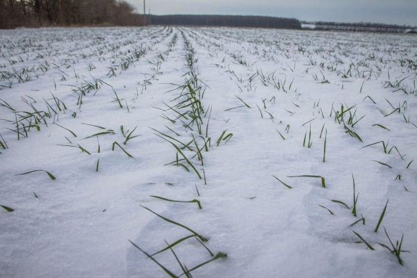
Overall, it will likely be a colder-than-normal winter in the Canadian Prairies.
Precipitation is expected to be normal with dry and wet periods balancing each other out. It is likely to be dry when it is cold and wet when it warms up in January.
“There will be enough snow falling to at least get some snow cover down,” he said.
Why it Matters: Winter weather is not nearly as important as spring and summer conditions, but it will have an influence on the U.S. winter wheat crop and on seeding conditions for next year’s crop.
Hamblin said the El Nino-Southern Oscillation (ENSO) is going to have the biggest impact on weather conditions in Canada and the United States.
“We’re right on the cusp of La Nina,” he said.
It is expected to be a weak La Nina that starts to fade in January.
He anticipates a winter like last year with above average temperatures in the eastern and southern United States and below average temperatures in the north-central region.
Hamblin anticipates an active storm track from the Tennessee Valley to the Great Lakes, while it should be dry across the south.
The Polar Vortex is expected to be weak, which means it will tend to dip south rather than staying “bottled up” in the higher latitudes.
When it dips south extreme cold temperatures will follow, but it is impossible to know where and when that will happen until about two weeks before it occurs.
“The cold air could easily just go over to Asia or Europe and leave us alone, or it could come down our way,” he said.
Stephen Strum, vice-president of extended forecast services with DTN, said there is a higher risk for cold conditions in the eastern half of the U.S. during the first half of winter.
In the second half of winter, the higher risk area switches to the Plains and to the northwest.
The south will be warmer than normal throughout most of the winter season.
Precipitation will be quite variable in the northern half of the country, while the south will be dry. The Tennessee Valley to the Great Lakes region will be wetter than normal.
“Most of the northern tier of the country does look to be snowier than average this winter season,” said Strum.
The central Plains will experience less than normal snowfall.
Strum said the forecast could change depending on how strong La Nina becomes and how long it lasts.
It will also be influenced by whether the Polar Vortex delivers shots of bitterly cold weather into North America or elsewhere around the world.
For almost 30 years of expertise in the agri markets, UkrAgroConsult has accumulated an extensive database, which became the basis of the platform AgriSupp.
It is a multi-functional online platform with market intelligence for grains and oilseeds that enables to get access to daily operational information on the Black Sea & Danube markets, analytical reports, historical data.
You are welcome to get a 7-day free demo access!!!


Got additional questions?
We will be happy to assist!
Write to us
Our manager will contact you soon