
Canada: Spring weather can be tough to forecast
Spring weather across our region is mostly caused by the battle between two air masses — one cold and to our north, and the other warm and to our south — and they are both at their strongest relative to each other at this time of the year.
On top of the large-scale battle between warm and cold air, we have a couple of smaller scale phenomena that can play havoc with spring weather and weather forecasting.
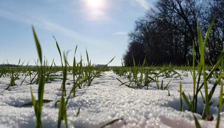
The biggest player in this spring weather havoc is the cold ground, or rather the cold snow sitting on the ground.
Snow reflects sunlight, which would, without snow cover, be absorbed by the ground and turned into heat. So, the reflectivity, or albedo, of snow helps to keep us cooler.
It takes energy to melt snow, lots of energy, and that energy comes in the form of heat.
Just how much energy does it take? Well, to melt snow you first need to warm the snow to just below the freezing mark. It takes about 2,000 joules per kilogram of snow to warm it one degree Celsius.
So, if we take an example of one kilogram of snow at -10 C, it would take 20,000 joules of energy to warm it up to the freezing or melting point.
Now, to get the snow or ice to change phase into water takes a lot more energy. This seemingly little push of temperature from just below freezing to just above freezing takes about 33,500 joules per kilogram.
You can see why areas with no snow cover can be significantly warmer than areas with snow cover.
The second havoc wreaker is something known as a temperature inversion.
This occurs when warm air moves into a region, but it rides up and over a very thin layer of cold air that in essence gets stuck at the surface.
Inversions, with warm air over cold air, create a very stable environment and can last for long periods of time. We often see this happen in the spring, thanks largely to the cooling effect of all the snow on the ground.
Sometimes it is a very large-scale event, in which ground temperatures are cool or cold, say in the -10 C range, while only a couple hundred feet up temperatures can be as warm as plus 10 or 15 C. This is why regions that are higher in elevation can sometimes have very mild spring weather while the rest of the region is stuck in the cold.

Along with being a large-scale event, this pattern often develops due to local topography.
The most affected regions are valleys or depressions. Whether the valley is small and deep or wide and shallow, cold air can settle into these low points and with the tendency for warm air to rise, it can sometimes be difficult for the warm air to scour or push the cold air out.
While this setup creates colder than expected temperatures across the region, it also can have an impact on cloud cover.
This warm air over a shallow layer of cold air will often result in overnight fog, which then transitions into low clouds that can sometimes stick around for days.
This mostly happens in areas that have shallow wide valleys or depressions such as the Red River Valley in Manitoba.
Next issue, a check to see what the latest spring outlooks are calling for.
For almost 30 years of expertise in the agri markets, UkrAgroConsult has accumulated an extensive database, which became the basis of the platform AgriSupp.
It is a multi-functional online platform with market intelligence for grains and oilseeds that enables to get access to daily operational information on the Black Sea & Danube markets, analytical reports, historical data.
You are welcome to get a 7-day free demo access!!!
Read also
MERCOSUR Agri Markets: The Forces Reshaping Global Supply
Corn prices in Ukraine are rising, but competition with Argentine grain is intensi...
Escalation of conflict around Iran could trigger rise in corn prices
Pig population in the EU has decreased slightly
Wheat exports from Ukraine exceeded 10 mln tons


Got additional questions?
We will be happy to assist!
Write to us
Our manager will contact you soon