
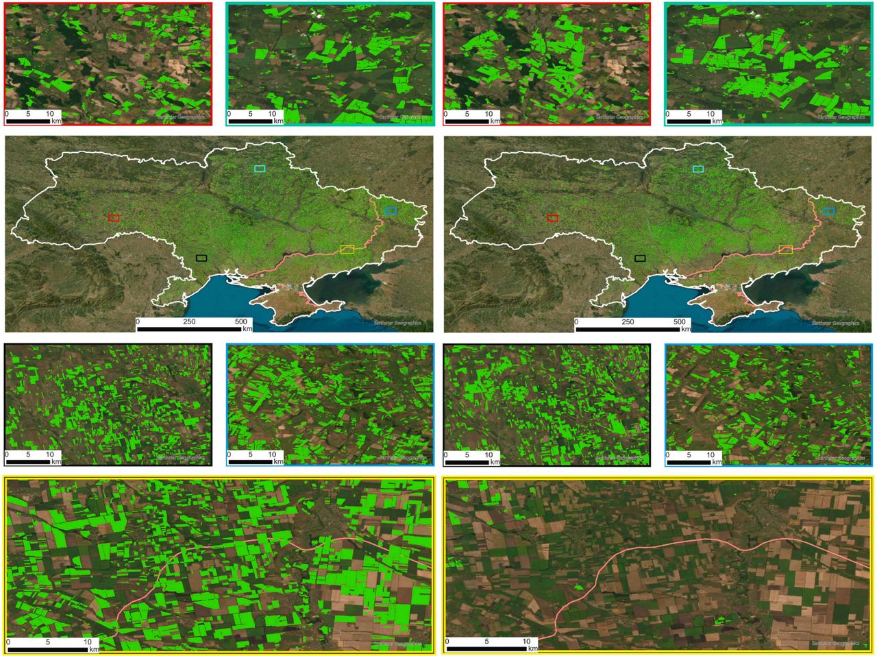
NASA Harvest used a new mapping method in Ukraine to show how sunseed production has changed in the country

In May 2024, researchers from the NASA Harvest Consortium presented a new method of mapping sunflower acreage using Earth observation radar satellites. This workflow was used to create a high-resolution (20 m) map of sunflower acreage in Ukraine, according to NASA Harvest.
The resulting map of sunflower acreage allowed for a better understanding of sunflower production across the country, in particular, how it has changed since the Russian invasion.
The analysis revealed a 5% decrease (loss of 3,500 square kilometers) in sunflower acreage in 2022 compared to 2021. Most of these losses were observed in the Russian-occupied regions, while there were no significant losses in the regions controlled by Ukraine. Within the occupied territories, the sunflower area decreased by 29% from 2021 to 2022.
A look at the acreage maps shows how sunseed production in the country has changed. As expected, the sunflower acreage has almost disappeared on the war frontline.
Comparing the 2021 and 2022 acreage maps, 9% of the fields were planted with sunflower for two years in a row.
Overall, the decline in sunflower production across Ukraine was less than expected.
For almost 30 years of expertise in the agri markets, UkrAgroConsult has accumulated an extensive database, which became the basis of the platform AgriSupp.
It is a multi-functional online platform with market intelligence for grains and oilseeds that enables to get access to daily operational information on the Black Sea & Danube markets, analytical reports, historical data.
You are welcome to get a 7-day free demo access!!!
Read also
Prices for palm oil ended trading lower on Wednesday
Jordan purchases 50 ерів tons of barley in tender
Argentina is experiencing its worst wine crisis in 15 years
Turkey Grain Market-2026: Trade Flows, Price Dynamics & Black Sea Competition
Bulgaria Sunflower Market Enters a New Phase of Intense Competition


Got additional questions?
We will be happy to assist!
Write to us
Our manager will contact you soon